
Features Outdooractive. Hike and Ride
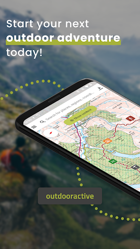
Confidently explore the great outdoors with Outdooractive - Hike and Ride: The most reliable outdoor navigation app, as trusted by thousands of trail wardens, mountain guides and outdoor industry professionals worldwide.
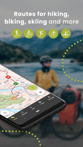
The Outdooractive - Hike and Ride app helps you find officially approved routes near you and around the world, with suggestions for dozens of sports including: hiking paths, trekking trails, mountain biking routes, trail running paths, ski touring routes and more.
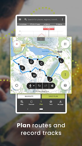
Or plan your own routes using the deepest catalog of official maps to take adventures into your own hands.
• Find routes you can rely on: Browse thousands of officially-approved routes near you and across the world, including routes for hiking, road cycling, bike touring, ski touring, gravel riding, trail running, horseback riding, mountaineering and more.
• Plan your own routes with tools trusted by professionals: Easily plot your own outdoor routes in the route planner in just a few taps, and see all need to know distance, elevation and terrain info.• Save everything offline: Save individual plans or entire areas offline for reliable navigation when you dont have a phone signal.
• Navigate with the most reliable maps on the planet: Browse the deepest collection of different map types to track or plan your adventures with confidence.
Simply switch between different layers to get a clearer picture of the terrain youre planning to visit, and get the most reliable understanding of conditions on the ground.
Outdooractives map catalog currently includes:Official topo maps in 25 countries, including:Ordnance Survey (Landranger & Explorer) in the United KingdomNew Zealand Land Information in NZUSGS in the USABKG in GermanyBEV in AustriaSwisstopo in SwitzerlandIGN in FranceCNIG in SpainPDOK in the NetherlandsKartverket in NorwayKortforsyningen in DenmarkLantmäteriet in SwedenFinland National Land Survey in FinlandGSI in JapanHarvey Maps in the UKs most mountainous areasThe official Alpine Club maps for climbing in the AlpsThe specially-designed Outdooractive map across France, Germany, Austria and Switzerland.• Share your live location with family and friends: Give yourself and your loved ones complete peace of mind when youre out in the great outdoors thanks to BuddyBeacon.• Join a global community of outdoor tourists and adventurers: Share your activities with the community, join challenges to stay motivated, and get inspired by officially-approved content from our thousands of industry partners.• Smartwatches with WEAR OS from Google: With a glance at your Smartwatch, you get information about your GPS position on the map.
You can record tracks, get tracking data and navigate along routes.
Use the app tile to easily access nearby routes.FAQs:Can Outdooractive find walking trails near me?Outdooractive helps you find walking, hiking, cycling and many more types of trails both in your area, and around the world.How can I find hiking trails near me?:Using Outdooractive, youre able to find hiking trails in your local area by opening our app and browsing the map.
Youll be able to see hiking trails with a range of distances, difficulties and distance from your location.How do I know which hiking trials close to me are best to follow?:Using Outdooractives multiple map layers, youre able to view official information from multiple sources, to inform you about trail conditions, rules, restrictions and what to expect on your hike.
Experts will share information on each route on its difficulty, required experience level and more!Can I download offline maps to navigate nature walks and areas to hike near me?:Outdooractive allows you to download maps and routes to your device before heading out, to help you navigate those areas where signal isnt guaranteed — allowing you to reliably navigate the outdoors.
Social Features
Connect and share with friends and the community.
Fitness Tracking
Track your workouts and monitor your health metrics.
Travel Features
Plan and manage your travels with ease.
See the Outdooractive. Hike and Ride in Action
Get the App Today
Available for Android 8.0 and above